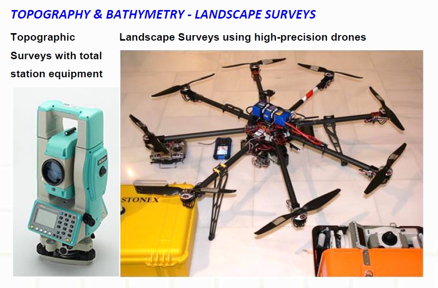
Having twenty eight (28) years of experience in Surveys of the Public and the Private Sector we conduct:
- Bathymetry measurements using an automated scanning system/equipment and high precision measurements and production of 3D models of sea-bed and river-bed
- Measurements to monitor small scale deformations (to protect structural integrity and functionality of the construction) and the creation of 3D models of high precision for important technical works ( bridges, dams e.t.c.) and buildings structures of high Historical and Archaeological value.
- Topographic studies on determining borderline foreshore and beach line, determination of river flood line.
In addition we offer modern services of Topographic – Photogrammetric methods using state-of-the-art equipment:
- Hardware (Robotic system of Unmanned Aerial Vehicle and a ground control station: UAV-Oktokopter Drone. GNSS of triple frequency integrated in EGSA’ 87
- Software (Photomodeler, etc)
Typical applications using UAV
- Detailed and documented (via Orthophotomap) 3D Property Registration, design of a Topographic Diagram (Topographical Chart) in accordance with Specifications
- Creation of Orthophotomap of the area integrated in the system EGSA’87, appropriate
- Modelling 3D objects buildings, bridges, churches etc.
- Building Digital Models of inaccessible areas (slopes landslides).
- Detailed mapping and documentation of archaeological sites and monuments
- Determination of the foreshore line
- 3D mapping of quarries
- 3D mapping of streams for a faster development of hydraulic studies, necessary for their delineation
- Recording of damage caused by earthquakes, landslides (Natural Disasters) in inaccessible areas, fast and safe (construction of a 3D Model of the area of landslides in a short period of time in order to make an immediate check of slope stability so as to launch actions for restoration as soon as possible.
- Works on construction sites: calculation of volumes of backfilling/trenches.
 English

