English
The dynamic nature of coastal zones, characterized by continuous changes in shoreline position due to natural and anthropogenic processes, presents significant challenges for coastal management and conservation efforts. Here’s an overview focusing on main areas of interest:
- Coastal Erosion in Europe
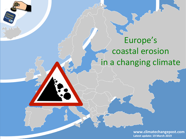
Coastal erosion affects all European coastal states to some extent. Approximately 20,000 kilometers of European coasts are eroding, with three-quarters actively retreating and one-quarter artificially stabilized.
The main consequences of this erosion include:
- Loss of economically valuable land.
- Destruction of natural sea defenses, such as dune systems, which can lead to the flooding of hinterland areas during storm events.
- Undermining of artificial sea defenses due to chronic sediment shortage.
The economic impact is substantial, with the average cost of coastal protection against erosion and flooding estimated at €5.4 billion per year between 1990 and 2020.
Erosion rates vary, with the upper limit for beach erosion generally around 2 meters per year, though locally it can reach or exceed 10 meters per year. Cliff erosion rates are typically in the order of decimetres up to 1 meter per year.
According to the IPCC, human activities are the primary drivers of widespread observed coastal erosion, more so than climate change. These activities include:
- Coastal engineering, where hard structures like seawalls, dykes, breakwaters, and jetties modify wave and flow patterns, leading to sediment redistribution that can cause erosion in some areas and accretion in others.
- River engineering, particularly damming, which effectively seals water catchments and locks up millions of cubic meters of sediment annually, resulting in a significant sediment deficit at river mouths and subsequent downstream erosion.
- Land reclamation within tidal basins or bays, which reduces tidal volume and alters ebb and flood currents, potentially causing previously stable coastal stretches to begin eroding.
- Dredging, which removes protective foreshore materials and contributes to the sediment deficit in coastal sediment cells.
- Vegetation clearing, which reduces the natural resistance of coastlines to erosion.
- Gas mining or water extraction, which can induce land subsidence, leading to sediment deficit and coastline retreat.
Climate change also contributes to erosion:
- Rising sea levels are found to accelerate the rate of erosion of rocky shorelines, even those that have been historically stable for thousands of years. This is expected to increase storm frequency and cause wave energy to move further inshore.
- In the Baltic States and Poland, increased storminess and a decline in sea ice protection, combined with direct human influences like port breakwaters interrupting sediment transport, have led to increased erosion.
- In the Russian Arctic, melting permafrost combined with rising sea levels causes rapid coastal recession, up to 2.5 meters per year, in areas with unconsolidated sediments.
- Methods/Measures Used for Erosion Mitigation
In recent decades, there has been a notable shift in coastal protection strategies in Europe, moving away from the construction of new ‘hard’ defenses towards an increasing use of ‘soft’ engineering methods. Hard structures, while offering immediate effectiveness, often cause more intensive erosion further downstream or in downdrift areas.
Hard Coastal Protection Works include:
- Seawalls, dykes, breakwaters, jetties, groins, transverse dikes, revetments, flood embankments, and placement of gabions and rock armoring. These structures modify wave and flow patterns, which can induce sediment redistribution, leading to erosion or accretion in different locations.
Soft Coastal Protection Methods are increasingly being used, sometimes in conjunction with hard measures:
- Beach and dune nourishment is a common and established methodology in several European countries. For example, the Netherlands has implemented a ‘Sand Engine,’ a concentrated mega-nourishment project where a large volume of sand is placed in one location to be naturally redistributed by waves, currents, and wind over time, allowing the coast to grow naturally. Denmark plans to increase sand nourishment volumes and heighten groins and breakwaters to counteract anticipated climate change effects, estimating an additional 17% artificial supply by 2050 and 49% by 2100. Greece utilizes beach nourishment, sediment recycling, and the stabilization of coastal dunes with vegetation as soft protection methods.
- Sediment recycling involves transporting sediment from the downdrift end of a beach back to its updrift end.
- Stabilization of coastal dunes with vegetation.
The IPCC recommends three main adaptation measures to address coastal erosion:
- Protection: This involves advancing or holding existing defense lines through options like land claim, beach and dune nourishment, artificial dunes, or the construction of hard structures such as seawalls, sea dikes, and storm surge barriers.
- Accommodation: This aims to increase flexibility and resilience through flood-proof land use, implementation of flood warning systems, or replacing armored shorelines with ‘living shorelines’.
- Retreat: This involves allowing wetlands to migrate inland, setting shorelines back, and introducing managed realignment by, for example, breaching coastal defenses to create intertidal habitats.
Key recommendations for managing coastal erosion in Europe include restoring the sediment balance, allocating necessary space for natural erosion and coastal sediment processes, and creating strategic sediment reservoirs (supplies of sediment for replenishment). Additionally, it’s recommended to transfer an appropriate part of the risk to direct beneficiaries and investors, move away from piecemeal solutions to a planned approach based on accountability, and strengthen the scientific knowledge base to avoid measures that locally exacerbate erosion problems elsewhere.
- Aquaterra’s Part in Coastal Erosion Mitigation
Aquaterra is a Geoscience & Engineering consulting company that offers services and solutions for coastal protection. The company is exclusively oriented towards the design of soft methods for protecting the coast from erosion. Aquaterra applies its expertise from applications in both Greece and internationally, including the USA (East & West Coast). A key aspect of their innovation is the application of an Aquaterra Patent.
- Main Commercial Hydrodynamic Software Used in Coastal Protection and Erosion Mitigation Measures Design
For designing coastal protection and erosion mitigation measures, several sophisticated hydrodynamic and morphodynamic software packages are widely used:
- Delft3D: This is a process-based numerical model system widely used for simulating the interaction of water, sediment, ecology, and water quality in coastal, river, and estuarine environments, as well as artificial environments like harbors and locks. Its “Delft3D Wave” component can simulate the propagation and transformation of random, short-crested, wind-generated waves and is used to transform offshore information into nearshore wave conditions or hydraulic loads on structures. The Delft3D-Scheldt-SLR model, for instance, was developed to forecast the morphological evolution of the Western Scheldt estuary under global sea level rise scenarios.
- MIKE 21 FM: This software, developed by the Danish Institute, is used for hydrodynamic simulations and is often compared with other models, such as Aphrodite3D, in various case studies.
- TELEMAC suite: An open-source system chosen for its ability to model inshore water levels and wave spectra with fine mesh resolution. It can be integrated with coarser models through a nesting procedure.
- XBeach or SBeach: These are more complex, process-based models particularly well-suited for simulating short-term scenarios like individual storm responses. However, they require significant computational resources and extensive calibration and input data, making them less suitable for large regional studies of shoreline change over multi-year periods.
- PISCES: A coastal area model that incorporates components like the TELEMAC flow model, the SWAN third-generation coastal area wave model, and the SANDFLOW sand transport module to simulate sediment transport and resulting bathymetry changes.
- Aquaterra’s Hydrodynamic and Morphodynamic Software for Conducting High-Resolution Analyses and for Erosion Mitigation Measures Design
Aquaterra utilizes its APHRODITE3D MODELING SOFTWARE, described as cutting-edge hydrodynamic simulation software, which employs advanced algorithms and 3D visualization techniques. This software is designed to revolutionize the field of hydrodynamics by offering highly accurate simulations for complex fluid dynamics.
Key capabilities and applications of Aphrodite3D include:
- Advanced Algorithms and Efficiency: It uses sophisticated numerical methods and computational fluid dynamics algorithms to solve complex hydrodynamic problems efficiently and accurately, providing valuable insights for engineers and researchers. By combining these advanced algorithms with powerful computing capabilities, Aphrodite3D delivers both high accuracy and computational efficiency, enabling rapid analysis of complex hydrodynamic phenomena.
- 3D Visualization Techniques: The software creates stunning 3D representations of fluid flow, allowing engineers to gain deeper insights into fluid behavior in various scenarios.
- High-Resolution Analyses: Aphrodite3D is specifically applied for generating high-resolution nearshore current circulation and seabed evolution. The Aphrodite2D version uses 2D continuity and momentum flow equations on a high-resolution numerical grid, offering options for finite-difference or finite volume numerical methods. It employs an orthogonal grid with small grid spacing to efficiently simulate the horizontal flow field and sediment transport in two dimensions.
- Morphodynamic Evolution: The software models the morphodynamic evolution of the seabed and shoreline. It predicts current flow and sediment transport, crucial for coastal protection and erosion control projects. Seabed morphology is calculated using established sediment transport formulas.
- Erosion Mitigation Measures Design: Aphrodite3D provides invaluable support for the design and optimization of complex hydrodynamic systems. It is used for Coastal Protection Technical Arrangement Solutions, coastal erosion control, and beach restoration. The software enables the prediction of short-term shoreline and seabed changes and can also predict medium-term morphology by adjusting grid resolution and time steps. It includes a calculation module to predict seabed evolution in terms of sand accumulation and erosion, which can be visualized in relief maps.
- Case Studies: Aphrodite3D has been effectively used in real-world scenarios, such as preliminary studies for coastal protection in Long Beach, CA, USA. In the Municipality of Western Achaia, Greece, it was used for hydrodynamic simulations and to model seabed morphology evolution near breakwaters, showing computed changes in seabed morphology like erosion and deposition. A study involving detached breakwaters demonstrated its ability to simulate sediment accumulation and scour patterns under different breakwater configurations (emerged, crest at MWL, submerged), with results showing qualitative agreement with expected conditions.
- Future Development: Aquaterra is committed to ongoing innovation, with plans to integrate state-of-the-art technologies such as machine learning and AI-driven optimization to further enhance the software’s capabilities. This will lead to efficient tools and easier & faster design of sophisticated solutions for adaptive coastal protection measures.
Coastal erosion is a complex dance between the ocean and the land, where human interventions often step on the toes of natural processes. Mitigation measures are like choreographers trying to guide this dance, sometimes using rigid walls (hard engineering) to block movement, but increasingly preferring to reshape the dance floor (soft engineering like beach nourishment) to work with the natural flow. Aquaterra’s Aphrodite3D software acts like a highly advanced, real-time simulator, allowing engineers to virtually practice these dance moves, predicting how the ocean and the land will respond to different interventions before implementing them in the real world, much like a meticulous choreographer plans every step to achieve a harmonious and sustainable performance.
References
Addo KA, Walkden M, Mills JPt (2008). “Detection, measurement and prediction of shoreline recession in Accra, Ghana.” ISPRS Journal of Photogrammetry and Remote Sensing. 63(5):543–558.
- Adcroft, A., Hill, C., Campin, J. M., Marshall, J., and Heimbach, P. (2004). “Overview of the formulation and numerics of the MIT GCM,” in Proceedings of the ECMWF Seminar Series on Numerical Methods, Recent Developments in Numerical Methods for Atmosphere and Ocean Modelling (Cambridge, MA), 139–149.
- Aleynik, D., Inall, M., Dale, A., and Vink, A. (2017). Impact of remotely generated eddies on plume dispersion at abyssal mining sites in the Pacific. Sci. Rep. 7, 1–14. doi: 10.1038/s41598-017-16912-2.
- Almeida, L. P., de Oliveira, I. E., Lyra, R., Dazzi, R. L. S., Martins, V. G., and da Fontoura Klein, A. H. (2021). Coastal analyst system from space imagery engine (CASSIE): shoreline management module. Environ. Modell. Softw. 140:105033. doi: 10.1016/j.envsoft.2021.105033.
- Alvarez-Cuesta, M., Toimil, A., and Losada, I. J. (2021). Modelling long-term shoreline evolution in highly anthropized coastal areas. Part 1: model description and validation. Coast. Eng. 169:103960. doi: 10.1016/j.coastaleng.2021.103960.
- Alzubi J, Nayyar A, Kumar A (2018). “Machine learning from theory to algorithms: an overview.” Journal of Physics: Conference Series. 1142:012012.
- Anderson, D., Rueda, A., Cagigal, L., Antolinez, J., Mendez, F., and Ruggiero, P. (2019). Time-varying emulator for short and long-term analysis of coastal flood hazard potential. J. Geophys. Res. Oceans 124, 9209–9234. doi: 10.1029/2019JC015312.
- Anderson, D., Ruggiero, P., Antolinez, J. A. A., Mendez, F. J., and Allen, J. (2018). A climate index optimized for longshore sediment transport reveals interannual and multi-decadal littoral cell rotations. J. Geophys. Res. Earth Surface 123, 1958–1981. doi: 10.1029/2018JF004689.
- Antolinez, J. A. A., Mendez, F. J., Camus, P., Vitousek, S., Gonzales, E. M., Ruggiero, P., et al. (2016). A multiscale climate emulator for long-term morphodynamics (MUSCLE-morpho). J. Geophys. Res. Oceans 121, 775–791. doi: 10.1002/2015JC011107.
- Archetti, R., Brocchini, M., 2002. An integral swash zone model with friction: an experimental and numerical investigation. Coastal Engineering 45, 89–110.
- Arakawa, A., and Lamb, V. (1977). “Computational design of the basic dynamical processes of the UCLA general circulation model,” in Methods in Computational Physics (San Diego, CA), 174–265. doi: 10.1016/B978-0-12-460817-7.50009-4.
- Bagheri M, Zaiton Ibrahim Z, Bin Mansor S, Abd Manaf L, Badarulzaman N, Vaghef N (2019). “Shoreline change analysis and erosion prediction using historical data of Kuala Terengganu, Malaysia.” Environmental Earth Sciences. 78(15):1–21. doi:10.1007/s12665-019-8459-x.
- Bagnold, R.A., 1940. Beach formation by waves: some model experiments in a wave tank. Journal of the Institution of Civil Engineers 15, 27–52.
- Bagnold, R.A., 1966. An Approach to the Sediment Transport Problem from General Physics. 422-I, US Geological Survey, Washington, DC.
- Bailard, J.A., 1981. An energetics total load sediment transport model for a plane sloping beach. Journal of Geophysical Research 86 (C11), 938–954.
- Baldock, T.E., Holmes, P., 1999. Simulation and prediction of swash oscillations on a steep beach. Coastal Engineering 36, 219–242.
- Baldock, T.E., Holmes, P., Horn, D.P., 1997. Low frequency swash motion induced by wave grouping. Coastal Engineering 32, 197–222.
- Baldock, T.E., Hughes, M.G. Field observations of instantaneous water slopes in the inner surf and swash zones. Continental Shelf Research, this issue, doi:10.1016/j.csr.2006.02.003.
- Barnard, P., Short, A. D., Harley, M. D., Splinter, K. D., Vitousek, S., Turner, I. I. L., et al. (2015). Coastal vulnerability across the Pacific dominated by El Ni no/southern oscillation. Nat. Geosci. 8, 1–8. doi: 10.1038/ngeo2539.
- Barnett, B., and Yamauchi, H. (1995). “Deep sea sediment resuspension system used for the Japan deep sea impact experiment,” in Proceedings of the First (1995) ISOPE Ocean Mining Symposium (Tsukuba), 175–179.
- Barthel, V and E.R. Funke (1989). Hybrid modelling as applied to hydrodynamic research and testing. In: Recent Advances in Hydraulic Physical Modelling, R. Martins (Ed), NATO ASI Series E: Applied Sciences – vol. 165, Kluwer Academic Publishers.
- Bascom, W.H., 1951. The relationship between sand size and beach face slope. Transactions, American Geophysical Union 32, 866–874.
- Bauer, B.O., Allen, J.R., 1995. Beach steps—An evolutionary perspective. Marine Geology 123, 143–166.
- Baeye, M., Fettwis, M., and Voulgaris, G. (2011). Sediment mobility in response to tidal and wind-driven flows along the Belgian inner shelf, southern North Sea. Ocean Dyn. 60, 611–622. doi: 10.1007/s10236-010-0370-7.
- Beach, R.A., Sternberg, R.W., 1991. Infragravity driven suspended sediment transport in the swash, inner and outer- surf zone. Proceedings Coastal Sediments ‘91, ASCE, pp. 114–128.
- Beach, R.A., Sternberg, R.W., Johnson, R., 1992. A fiber optic sensor for monitoring suspended sediment. Marine Geology 103, 513–520.
- Benoit, M., Marcos, F. and Becq, F., (1996). Development of a third generation shallow water wave model with unstructured spatial meshing, 25th international Conference on Coastal Engineering, Orlando, pp. 465-478.
- Berkhoff, J. C.W. (1972). ‘Computation of combined refraction and diffraction’, Proceedings of the 13th International Coastal Engineering Conference, ASCE, 471-490.
- Berkhoff, J. C.W. (1976). Mathematical models for simple harmonic linear water waves; wave refraction and diffraction. PhD thesis, Delft Technical University of Technology.
- Berrisford, P., Dee, D., Poli, P., Brugge, R., Fielding, K., Fuentes, M., et al. (2011). The Era-Interim Archive Version 2.0, Era Report Series 1. Technical report, ECMWF, Shinfield Park, Reading, United Kingdom.
- BGR (2019). Environmental Impact Assessment for the Testing of a Pre-Protoype Manganese Nodule Collector Vehicle in the Eastern German License Area (Clarion-Clipperton Zone) in the Framework of the European JPI-O Miningimpact 2 Research Project. BGR, 1–203.
- Bi Q, Goodman KE, Kaminsky J, Lessler J (2019). “What is machine learning? A primer for the epidemiologist.” American Journal of Epidemiology. 188(12):2222–2239.
- Birkemeier,W.A., and R.A. Dalrymple (1975). Nearshore Water Circulation Induced by Wind and Waves. Proceedings of Modeling 75, ASCE, San Francisco.
- Bodge, K.R., Dean, R.G., 1987. Short-term impoundment of longshore transport. Proceedings Coastal Sediments ‘87, ASCE, pp. 468–483.
- Booij, N., L.H. Holthuijsen, and T.H.C. Herbers (1985). A Numerical Model for Wave Boundary Conditions in Port Design. Proc. Intl. Conf. Numerical and Physical Modeling of Ports and Harbours, BHRA, Birmingham, 263–268.
- Booij, N., and L.H. Holthuijsen (1987). Propagation of Ocean Waves in Discrete Spectral Wave Models. J. Computational Physics, 68, 307–326.
- Bouma, H., De Jong, D. J., Twisk, F., & Wolfstein, K. (2005). Zoute wateren Ecotopen-Stelsel (ZES.1) / A Dutch Ecotope System for Coastal Water (ZES.1) [Publisher: Rijkswaterstaat, RIKZ]. Rapportnr.: 2005.024. Retrieved May 16, 2024, from https://repository.tudelft.nl/islandora/object/uuid%3Aa31936f4-db7c-4df1-b456-52a6c7bde532.
- Bradshaw, M., Bores and swash on natural beaches, 82/4, 1982, Sydney University (Australia), Coastal Studies Unit..
- Brenninkmeyer, S.J., 1976. In situ measurements of rapidly fluctuating, high sediment concentrations. Marine Geology 20, 117–128.
- Brink-Kjaer, 0. (1984) Depth-Current Refraction of Wave Spectra”, Proceedings of Symposium on Description and Modelling of Directional Seas, Tech. Univ. of Denmark, paper No.C7.
- Brocchini, M., Drago, M. and Ivoenitti, L. (1992). ‘The modeling of short waves in shallow water: Comparison of numerical model based on Boussinesq and Serre equations.’ Proc. 23rd Intnl. Conf. Coastal Engng. ASCE. 76-88.
- Brown J, Wolf J (2009). Coupled wave and surge modelling for the eastern Irish Sea and implications for model wind-stress. Continental Shelf Research, 29, 1329-1342.
- Brown, J.M., Bolaños, R., Wolf, J., (2011). Impact assessment of advanced coupling features in a tide-surge-wave model, POLCOMS-WAM, in a shallow water application. Journal of Marine Systems (in press).
- Bruun, P. (1962). Sea level rise as a cause of shore erosion. J. Waterways Harbors Div. 88, 117–130.
- Buhmann JM, Maass W, Ritter H, Tishby N (1999). Unsupervised learning (Dagstuhl Seminar 99121). Schloss-Dagstuhl-Leibniz Zentrum für Informatik.
- Burcharth, H.F., Liu, Z., Troch, P., (1999). Scaling of core material in rubble mound breakwaters model test. In: Proc. of the 5th International Conference on Coastal Engineering in Developing Countries (COPEDEC), Capetown, pp. 1518–1528.
- Burns, R., Halbach, P., Friedrich, G., and Stackelberg, U. V. (1990). The manganese nodule belt of the pacific ocean. Geological environment, nodule formation, and mining aspects. Geol. Mag. 127:93. doi: 10.1017/S0016756800014394.
- Butt, T., Russell, P., 1999. Suspended sediment transport mechanisms in high-energy swash. Marine Geology 161, 361–375.
- Butt, T., Russell, P., 2000. Hydrodynamics and cross-shore sediment transport in the swash-zone of natural beaches: a review. Journal of Coastal Research 16, 255–268.
- Butt, T., Russell, P., Turner, I., 2001. The influence of swash infiltration–exfiltration on beach face sediment transport: onshore or offshore? Coastal Engineering 42, 35–52.
- Butt, T., Russell, P.E., Masselink, G., Miles, J.R., Huntley, D.A., Evans, D., Ganderton, P., 2002. An integrative approach to investigating the role of swash in shoreline change. Proceedings 28th International Conference on Coastal Engineering, ASCE, pp. 917–928.
- Butt, T., Russell, P., Puleo, J.A., Miles, J., Masselink, G., 2004. The influence of bore turbulence on sediment transport in the swash and inner surf zones. Continental Shelf Research 24, 757–771.
- Butt, T., Russell, P., Puleo, J.A., Masselink, G., 2005. The application of Bagnold-type sediment transport models in the swash zone. Journal of Coastal Research 21, 887–895.
- Cahyono, M., (1992). “Three Dimensional Numerical Modelling of Sediment Transport Processes in Non-stratified Estuarine and Coastal Waters”, PhD Thesis, Department of Civil Engineering, University of Bradford, Bradford, UK.
- Caruana R, Niculescu-Mizil A (2006). “An empirical comparison of supervised learning algorithms.” Proceedings of the 23rd International Conference on Machine Learning:161–168.
- Castelle, B., Bujan, S., Marieu, V., and Ferreira, S. (2020). 16 years of topographic surveys of rip-channelled high-energy meso-macrotidal sandy beach. Sci. Data 7, 1–9. doi: 10.1038/s41597-020-00750-5.
- Castelle, B., Marieu, V., Bujan, S., Splinter, K. D., Robinet, A., Sénéchal, N., et al. (2015). Impact of the winter 2013-2014 series of severe Western Europe storms on a double-barred sandy coast: beach and dune erosion and megacusp embayments. Geomorphology 238, 135–148. doi: 10.1016/j.geomorph.2015.03.006.
- Castelli M, Vanneschi L, Largo ÁR (2018). “Supervised learning: classi�cation.” Por Ranganathan, S., M. Grisbskov, K. Nakai y C. Schönbach. 1:342–349.
- Chen, Q., Madsen, P. A., Schaffer, H. A. and Basco, D. R., (1998). ‘Wave-current interaction based on an enhanced Boussinesq approach’, Coastal Engng., 33, 11-39.
- Chen, Y. and Liu, P. L.-F. (1995). ‘Modified Boussinesq equations and associated parabolic models for water wave propagation,’ J. Fluid Mech., 288, 351-381.
- Chau, KW (2010). Modelling for coastal hydraulics and engineering, Taylor and Francis Ltd., 231 pp.
- Chini, N. and Stansby, P.K. (2012). Extreme values of coastal wave overtopping accounting for climate change and sea level rise. Coastal Engineering, 65, 27-37.
- Clarke, D.J., Eliot, I.G., May, P.E. and Smith, R.K., 1984. Tidal control on beachface sorting during accretion and erosion. Marine Geology 60, 291–307.
- Coco, G., Senechal, N., Rejas, A., Bryan, K. R., Capo, S., Parisot, J. P., et al. (2014). Beach response to a sequence of extreme storms. Geomorphology 204, 493–501. doi: 10.1016/j.geomorph.2013.08.028.
- Coco, G., O’Hare, T.J., Bradford, M.A., 2000. The effect of swash-groundwater interaction on beachface morphology: a numerical study. Marine Geology 168, 177–187.
- Conley, D.C., Griffin, J.G., 2004. Direct measurements of bed stress under swash in the field. Journal of Geophysical Research 109, C03050.
- Conley, D.C., Inman, D.L., 1994. Ventilated oscillatory bound-ary-layers. Journal of Fluid Mechanics 273, 261–284.
- Cooper, J., Masselink, G., Coco, G., Short, A., Castelle, B., Rogers, K., et al. (2020). Sandy beaches can survive sea-level rise. Nat. Clim. Change 10, 993–995. doi: 10.1038/s41558-020-00934-2.
- Cooper, J. A. G., and Pilkey, O. H. (2004). Sea-level rise and shoreline retreat: time to abandon the Bruun Rule. Glob. Planet. Change 43, 157–171. doi: 10.1016/j.gloplacha.2004.07.001.
- Cowell, P.J., Thom, B.G., 1994. Morphodynamics of coastal evolution. In: Carter, R.W.G., Woodroffe, C.D. (Eds.), Coastal Evolution: Late Quaternary Shoreline Morphody-namics. Cambridge University Press, Cambridge, pp. 33–86.
- Cowen, E.A., Sonu, I.M., Liu, P.L.-F., Raubenheimer, B., 2003. PIV measurementswithin a laboratory generated swash zone. Journal of Engineering Mechanics 129, 1119–1129.
- Cox, D.T., Hobensack, W.A., Sukumaran, A., 2000. Bottom stress in the inner surf and swash zone. Proceedings 27th International Conference on Coastal Engineering, ASCE, pp. 108–119.
- D’Anna, M., Castelle, B., Idier, D., Rohmer, J., Le Cozannet, G., Thieblemont, R., et al. (2021a). Uncertainties in shoreline projections to 2100 at Truc Vert Beach (France): role of sea-level rise and equilibrium model assumptions. J. Geophys. Res. Earth Surface 126, 1–26. doi: 10.1029/2021JF006160.
- D’Anna, M., Idier, D., Castelle, B., Le Cozannet, G., Rohmer, J., and Robinet, A. (2020). Impact of model free parameters and sea-level rise uncertainties on 20-years shoreline hindcast: the case of Truc Vert beach (SW France). Earth Surface Process. Landforms 45, 1895–1907. doi: 10.1002/esp.4854.
- D’Anna, M., Idier, D., Castelle, B., Vitousek, S., and Le Cozannet, G. (2021b). Reinterpreting the Bruun Rule in the context of equilibrium shoreline models. J. Marine Sci. Eng. 9:974. doi: 10.3390/jmse9090974.
- Dalrymple, R.A., Thompson, W.W., 1976. Study of equilibrium profiles. Proceedings 15th International Conference on Coast-al Engineering, ASCE, pp. 1277–1296.
- Davidson, M., Turner, I., Splinter, K. D., and Harley, M. D. (2017). Annual prediction of shoreline erosion and subsequent recovery. Coast. Eng. 130, 14–25. doi: 10.1016/j.coastaleng.2017.09.008.
- Davidson-Arnott, R. G., and Bauer, B. O. (2021). Controls on the geomorphic response of beach-dune systems to water level rise. J. Great Lakes Res. (in press). doi: 10.1016/j.jglr.2021.05.006.
- Dean, R.G., 1973. Heuristic models of sand transport in the surf zone. Proceedings of First Australian Coastal Engineering Conference, AIE, pp. 208-214.
- De Vet, P. L. M., Van Prooijen, B. C., & Wang, Z. B. (2017). The differences in morphological development between the intertidal flats of the Eastern and Western Scheldt. Geomorphology, 281, 31–42. https://doi.org/10.1016/j.geomorph.2016. 12.031.
- De Vriend, H.J., (1986). “Two and Three Dimensional Mathematical Modelling of Coastal Morphology”, Report No. H284-2, Delft Hydraulics Laboratory, Delft, The Netherlands.
- De Vriend, H. J., Wang, Z. B., Ysebaert, T., Herman, P. M. J., & Ding, P. (2011). Eco-Morphological Problems in the Yangtze Estuary and the Western Scheldt. Wetlands, 31(6), 1033–1042. https://doi.org/10.1007/s13157-011-0239-7.
- Depreiter, D. (2012). Flexible Disposal Strategy: Monitoring as a key to understanding and steering environmental responses to dredging and disposal in the Scheldt Estuary. Hydro12 – Taking care of the sea. https://doi.org/10.3990/2.232.
- Dissanayake, P., Brown, J., Wisse, P., and Karunarathna, H. (2015). Effects of storm clustering on beach/dune evolution. Marine Geol. 370, 63–75. doi: 10.1016/j.margeo.2015.10.010.
- Dixen, M. (2008). Interaction between seabed and scour protection, Ph.D. Thesis, Technical University of Denmark Department of Mechanical Engineering, Coastal, Maritime and Structural Engineering Section.
- Dixen, M., Sumer, B.M. and Fredsoe, J. (2010). Flow and scour around a half-buried sphere. In preparation.
- Doria, A., Guza, R., O’Reilly, W. C., and Yates, M. (2016). Observations and modeling of San Diego beaches during El Ni no. Continent. Shelf Res. 124, 153–164. doi: 10.1016/j.csr.2016.05.008.
- Drake, T.G., Calantoni, J., 2001. Discrete particle model for sheet flow sediment transport in the nearshore. Journal of Geophysical Research 106, 19859–19868.
- Dubois, R.N., 1972. Inverse relation between foreshore slope and mean grain size as a function of the heavy mineral content. Geological Society of America Bulletin 83, 871–876.
- Duncan, J.R., 1964. The effects of water table and tide cycle on swash-backwash sediment distribution and beach profile development. Marine Geology 2, 186–197.
- Dyer, K. R. (1989). Sediment processes in estuaries: future research requirements. J. Geophys. Res. 94, 14327–14339. doi: 10.1029/JC094iC10p14327.
- Ebersole, B.A., and R.A. Dalrymple (1980). Numerical Modelling of Nearshore Circulation. Proc. 17th Intl. Conf. Coastal Eng., ASCE, Sydney.
- Eckart, C. (1952). ‘The propagation of gravity waves from deep to shallow water’. Circular 20, National Bureau of Standards, 165-173.
- El-Ashmawy N, Hosny M, El Shouny A, Haggag G (2015). “Predicting future shoreline in Red Sea area: geomatics study.” Regional Conference on Surveying & Development.
- Elgar, S. and Guza, R. T. (1985). ‘Shoaling gravity waves: comparisons between field observations, linear theory and a nonlinear model’, J. Fluid Mech., 158, 47-70.
- Elias, E. P. L., Van Der Spek, A. J. F., Wang, Z. B., Cleveringa, J., Jeuken, C. J. L., Taal, M., & Van Der Werf, J. J. (2023). Large-scale morphological changes and sediment budget of the Western Scheldt estuary 1955-2020: The impact of large-scale sediment management. Geologie en Mijnbouw/Netherlands Journal of Geosciences, 102(1-3). https://doi.org/10.1017/njg.2023.11.
- Elfrink, B., Baldock, T.E., 2002. Hydrodynamics and sediment transport in the swash zone: a review and perspectives. Coastal Engineering 45, 149–167.
- Eliot, I.G., Clarke, D.J., 1986. Minor storm impact on the beachface of a sheltered sandy beach. Marine Geology 73, 61–83.
- Eliot, I.G., Clarke, D.J., 1988. Semi-diurnal variation in beach face aggradation and degradation. Marine Geology 79, 1–22.
- Elmilady, H., Van Der Wegen, M., Roelvink, D., & Jaffe, B. E. (2019). Intertidal Area Disappears Under Sea Level Rise: 250 Years of Morphodynamic Modeling in San Pablo Bay, California. Journal of Geophysical Research: Earth Surface, 124(1), 38–59. https://doi.org/10.1029/2018JF004857.
- Emery, K.O., Gale, J.F., 1951. Swash and swash mark. Transactions, American Geophysical Union 32, 31–36.
- Erikson, L., Larson, M., Hanson, H., 2005. Prediction of swash motion and run-up including the effects of swash interaction. Coastal Engineering 52, 285–302.
- Falconer, R.A. and Chapman, B.C., (1996). “Design and Operation of a Laboratory Tidal Basin for Model Harbour Studies”, Dock and Harbour Authority, Vol. 746, No. 864, pp. 175-179.
- Falconer, R.A., George, G.D. and Hall, P., (1991). “Three Dimensional Numerical Modelling of Wind Driven Circulation in a Shallow Homogeneous Lake”, Journal of Hydrology, Vol. 124, pp. 59-79.
- Flather RA (2000). Existing operational oceanography. Coast Eng 41(1–3):13–40.
- Flather RA (1981). Practical surge predictions using numerical models. In: Peregrine DH (ed) Floods due to high winds and tides. Academic Press, London, pp 21–43.
- Flather RA, Williams JA (2004). Future development of operational storm surge and sea level prediction. Proudman Oceanographic Laboratory, Internal Document, No 165, 69 pp.
- Flick, R.E. and George, R.A., 1990. Turbulence scales in the surf and swash. Proceedings of the 22nd International Conference on Coastal Engineering, ASCE, pp. 559–569.
- Frazer, L. N., Anderson, T. R., and Fletcher, C. H. (2009). Modeling storms improves estimates of long-term shoreline change. Geophys. Res. Lett. 36:L20404. doi: 10.1029/2009GL040061.
- Fredsøe, J. and Deigaard, R., 1992. Mechanics of Coastal Sediment Transport. Advanced Series on Ocean Engineering, vol. 3, World Scientific Publishing, Singapore.
- Freeman, J.C., Le Méhauté, B., 1964. Wave breakers on a beach and surges on a dry bed. Journal of the Hydraulics Division 90, 187–216.
- Freire, P., Sancho, F., Oliveira, F.S.B.F. (2009). Composite modelling of sediment dynamics for propagating waves reaching coastal defences. In: 2nd Int. Conf. Application of Physical Modelling to Port and Coastal Protection (L. Damiani, M. Mossa, eds.) IAHR, Madrid, pp. 125-135.
- Frantz, Megan (2020). Classifying Seabed Parameters from Normal Incidence Reflections: Model Comparison and Inversion Technique. Portland State University..
- Fukushima, T. (1995). “Japan overview deep-sea impact experiment (JET),” in Proceedings of ISOPE Ocean Mining Symposium (Tsukuba), 47–53.
- Galappatti, R. and Vreugdenhil, C.B. (1985). “A Depth Integrated Model for Suspended Sediment Transport”, Journal of Hydraulic Research, Vol. 23, No. 4, pp. 359-377.
- Gardner, W., Southhard, J., and Hollister, C. (1985). Benthic storms, nepheloid layers, and linkage with upper ocean dynamics in the western North Atlantic. Mar. Geol. 65, 199–242.
- Gardner, W., Tucholke, B., Richardson, M., and Biscaye, P. (2017). Benthic storms, nepheloid layers, and linkage with upper ocean dynamics in the western North Atlantic. Mar. Geol. 385, 304–327. doi: 10.1016/j.margeo.2016.12.012.
- Geeraerts, J.; Kortenhaus, A.; Gonzalez-Escriva, J.A.; De Rouck, J.; Troch, P. (2009). Effects of new variables on the overtopping discharge at steep rubble mound breakwaters – The Zeebrugge case Coast. Eng. 56(2): 141-153.
- Gerritsen, H., Sutherland, J., Deigaard, R., Sumer, B.M., Fortes, J, Sierra, J-P and Prepernau, U, (2009). Guidelines for Composite Modelling of the Interactions Between Beaches and Structures. Final Report, September, 66 pages, (HYDRALAB-III Deliverable JRA1.4).
- Gill AE (1982). Atmosphere-ocean dynamics. Academic Press, London, 662 pp. Goring, D. G. (1978) Tsunamis – the propagation of long waves onto a shelf, Ph.D. dissertation, California Institute of Technology, Pasadena, CA.
- Gillard, B., Purkiani, K., Chatzievangelou, D., Vink, A., Iversen, M. H., and Thomsen, L. (2019). Physical and hydrodynamic properties of deep sea mining-generated, abyssal sediment plumes in the clarion clipperton fracture zone (eastern-central pacific). Elem Sci. Anth. 7, 1–14. doi: 10.1525/elementa.343.
- Glover, A., and Smith, C. (2003). The deep-sea floor ecosystem: current status and prospects of anthropogenic change by the year 2025. Environ. Conserv. 30, 219–241. doi: 10.1017/S0376892903000225.
- Gollner, S., Kaiser, S., Menzel, L., Jones, D. O., Brown, A., Mestre, N. C., et al. (2017). Resilience of benthic deep-sea fauna to mining activities. Mar. Environ. Res. 129, 76–101. doi: 10.1016/j.marenvres.2017.04.010.
- Gomez-De La Peña E, Coco G, Whittaker C, Montaño J (2023). “On the use of convolutional deep learning to predict shoreline change.” Earth Surface Dynamics. 11(6):1145–1160. doi:10.5194/esurf-11-1145-2023.
- Goudas C, Kapopoulos Ch, Psarropoulou E (2006). The Experience of the University of Patras – INTEREG IIIC BEACHMED-e ‘PHASE A Conference’ , Alexandroupoli, Greece.
- Goudas C, Kapopoulos Ch, Psarropoulou E (2008). Integrated Coastal Zone Management-The Global Challenge, Chapter 14: Soft Shore Protection: Theory and Practice, Research Publishing, Singapore.
- Goudas C, Kapopoulos Ch, Psarropoulou E (2011). Soft Shore Protection: Evaluation of experimental applications, MEDCOAST 2011, Rhodes Island, Greece.
- Gourlay, M.R., 1968. Beach and dune erosion tests. Rep. M935/M936, Delft Hydraulics Laboratory, Delft, Netherlands.